
From the Archives March 19, 2006:
The now-defunct Monthly Marathon Blog inspired this post two years ago. I was very pleased with some of these pictures. When I heard this week that the City of Rome is planning a new Silver Creek Park in downtown Rome where some of these pictures were taken, I thought I'd take this post out of mothballs. The new park would include the area shown in the final four photos and the old postcard below.
Here is a map of the proposed trails and park.And here are the Rome News reports:
Rome News 1
Rome News 2
Rome News 3
******************************
A River Walk
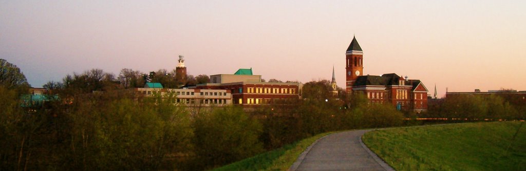

Our courthouse reflected in the Oostanaula
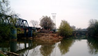
The confluence of the Oostanaula (left) and Etowah (right) rivers to form the Coosa River. The bridge at the right is the Robert Redden Footbridge, a former railroad bridge that rotated on the center column so steamboats could continue up the Oostanaula. The bridge at the right takes Broad Street across the Etowah to the foot of Myrtle Hill.

The Silver Creek Trail crosses the Etowah on another railroad bridge turned footbridge (above) then follows little Silver Creek for three-quarters of a mile as it cascades down to the river.
I've lived in Rome since 1962, but I was completely ignorant of these picturesque downtown views until last week!

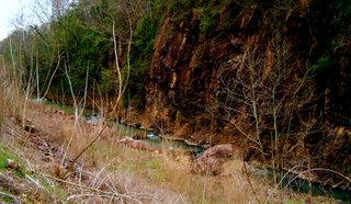
Notice the nearly vertical sandstone and shale layers, evidence of the crumpling of the former sea floor here in the Ridge and Valley province between the Blue Ridge and the Cumberland Plateau. At our school I can take my kids out to the driveway cut and pull shell fossils and crinoid stems from the crumbly sandstone.
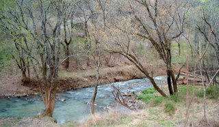
The creek flattens a little as it nears the river.
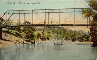
The 1913 postcard (above) shows a mill on Silver Creek. I suspect the foreground is a bridge over the Etowah and the mill was at the mouth of Silver Creek. Or else it is high water on some other section of the creek. If anyone knows where this picture was taken, please let me know.
By the Way: Don't forget to get your submissions in to Learning In The Great Outoors, the carnival of environmental education, hosted for April by Barb at The Heart of Harmony. You can use this handy submission form.
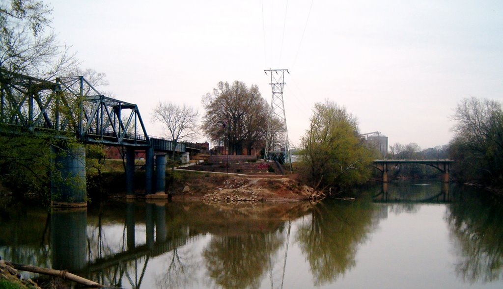
The confluence of the Oostanaula (left) and Etowah (right) rivers to form the Coosa River. The bridge at the right is the Robert Redden Footbridge, a former railroad bridge that rotated on the center column so steamboats could continue up the Oostanaula. The bridge at the right takes Broad Street across the Etowah to the foot of Myrtle Hill.

The Silver Creek Trail crosses the Etowah on another railroad bridge turned footbridge (above) then follows little Silver Creek for three-quarters of a mile as it cascades down to the river.

I've lived in Rome since 1962, but I was completely ignorant of these picturesque downtown views until last week!

Notice the nearly vertical sandstone and shale layers, evidence of the crumpling of the former sea floor here in the Ridge and Valley province between the Blue Ridge and the Cumberland Plateau. At our school I can take my kids out to the driveway cut and pull shell fossils and crinoid stems from the crumbly sandstone.
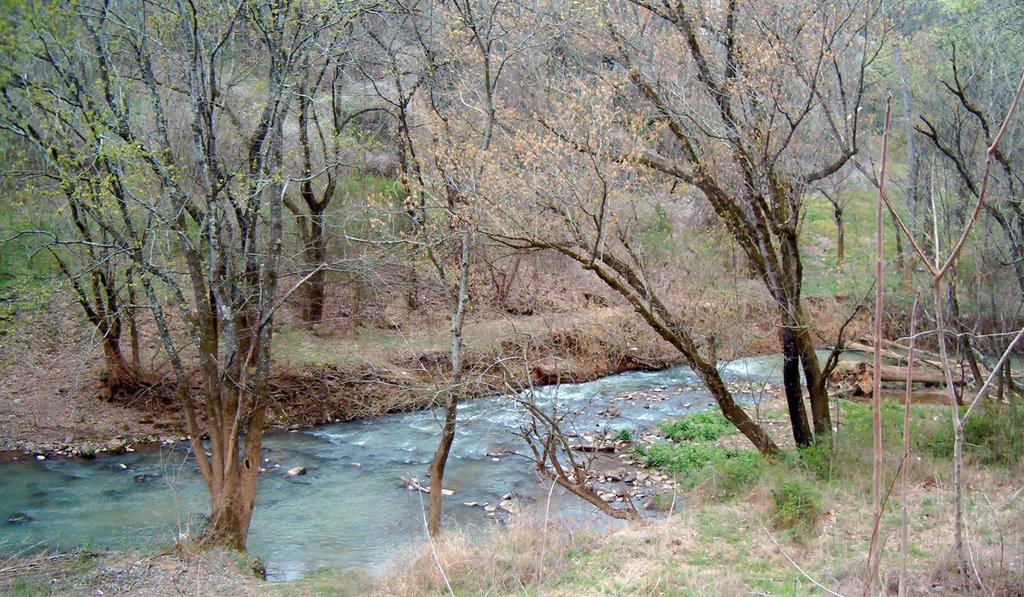
The creek flattens a little as it nears the river.
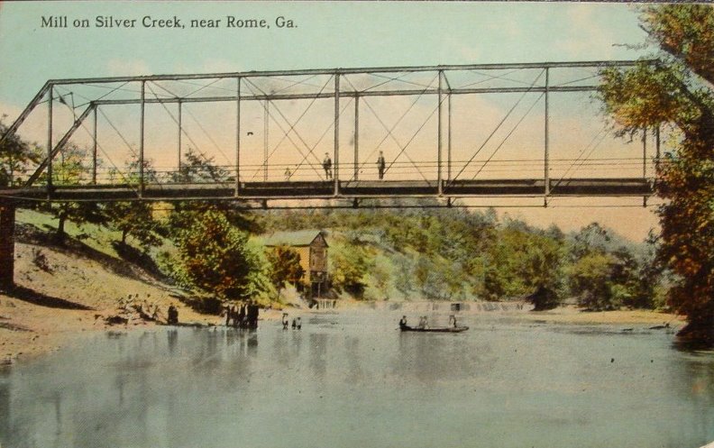
The 1913 postcard (above) shows a mill on Silver Creek. I suspect the foreground is a bridge over the Etowah and the mill was at the mouth of Silver Creek. Or else it is high water on some other section of the creek. If anyone knows where this picture was taken, please let me know.
*******
By the Way: Don't forget to get your submissions in to Learning In The Great Outoors, the carnival of environmental education, hosted for April by Barb at The Heart of Harmony. You can use this handy submission form.
No comments:
Post a Comment